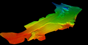
 Topographic contouring obtained through laser scanning can quickly and accurately create a 3D model of existing terrain conditions. The ability to have this information is essential in computing volume calculations for earth movement.
High definition laser scanning survey data uses:
- Assessing grades for accurate drainage
- Verifying as-built data to assure proper construction
- High accuracy grading such as golf courses and playing fields
The ability to acquire, document and model information to extremely accurate levels in a short amount of time results in faster turnaround, lower costs, and better construction.


