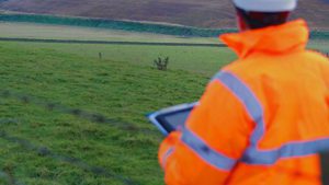
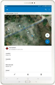
The ability to view your GIS data in the field is an extremely valuable tool. Field technicians can view asset locations and attribute information, as well as their own location relative to the asset, all in real time. This enables field and office staff to plan ahead and see what is needed to complete a task before mobilizing to the project site. This capability substantially enhances communication and allows for effective problem-solving in real-time. Field technicians can view details about the asset under their feet and easily communicate details between stakeholders. They can also make edits to the asset in the field and send it back to the office with a click of a button. LandTech can assist in configuring the apps as well as provide training.
Use Case Example: When a water main breaks in the middle of winter, under 2 feet of snow, finding the valve to shut the water main off to start repairs can be a daunting task. Using mobile 2D, 3D or virtual reality GIS application, a field worker can place themselves right over the necessary valve to begin their work. By deploying this solution, money, time and a lot of frustration are saved.
Benefits:
– Less time searching for assets in the field
– Assets can be viewed and edited in the field and sent back to the office in real time
– Lowers danger and risks associated with being in the field
– Integration with asset management software