


CREATE
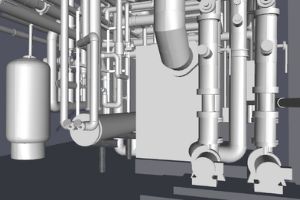
Providence Water was undertaking a major redesign and improvement project to keep up with increasing demand. They approached LandTech Consultants for a pilot project with the goals of integrating the BIM model of their facility with GIS for asset management and improving their field operations. LandTech was hired to create existing condition documentation of the facility via a LIDAR survey and deliver a point cloud and a building information model developed to LOD 300.
INNOVATE
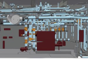
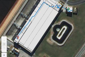
Providence Water had detailed asset information, but besides a room description, had no physical location information or visualization on a map. Their BIM model was imported into ArcGIS Pro and converted into a geodatabase. ‘Virtually’ walking through the model in ArcGIS Pro, each feature was identified and tagged with the appropriate asset ID from the Cityworks database. LandTech brought the BIM model into the ArcGIS Indoors database to allow for data visualization and navigation between assets. For example, if a field technician receives a work order for a specific asset and does not know where it is located, they can query for that asset ID and get turn-by-turn navigation from their location to the asset, as well as view the asset in both 2D and 3D. Attribute data and work order information can be retrieved directly from the Citywork database to assist the field technicians while on-site.
INTEGRATE
Providence was impressed with the deliverables and see the benefit in deploying the solution system-wide. The next phases of the project include the capturing and modeling of the remaining facilities and further integration between the GIS model and the Cityworks database.
Download Providence Water Case Study PDF