


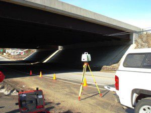
 Since the formation of LandTech in 1990, no one area of our services has seen greater advances in technology than land surveying. Our survey professionals utilize the latest technologies in robotics, Global Positioning Systems (GPS) and LiDAR, also known as Laser Scanning, to produce vast amounts of extremely accurate information in a very short period of time.
The existing characteristics and constraints of a parcel of land or of a developed site often define the potential for development, renovation and financing. The acquisition of accurate data is crucial in forming the basis of a successful project.
Construction projects require precise and accurate layout, often in less than ideal conditions and under tight time constraints. Often field crews are called upon to respond with little notice to keep construction schedules intact.
Design and construction projects have no room for error. Having access to a variety of technologies allows LandTech to choose the best technology to complete the job in the least amount of time and with the greatest accuracy.
Advances in technology are only as good as the individuals that utilize them. Our field and office staff is trained to utilize the latest equipment in the most appropriate areas for cost effective and accurate solutions.
Land Surveying/Geomatics Services Include:
- Boundary Survey
- Topographic/Existing Conditions
- Aerial Control
- Construction Layout
- Certified Plot Plans
- ALTA/ASCM Surveys
- Deformation Monitoring
- GPS Real Time Kinetic Processing
- GIS Data Collection
- 3D Laser Scanning